Tag Archives: Giuseppe Strappa

OBSERVATIONS ON URBAN GROWTH


FrancoAngeli, Milan 2018

OBSERVATIONS ON URBAN GROWTH    
edited by Giuseppe Strappa


CONTENTS
Presentation
The form of expanding cities  – Giuseppe Strappa
Metropolis in transformation .

A study of fringe belts in Belo Horizonte, Brazil:
a contribution to developments in urban morphology
Staël de Alvarenga Pereira Costa, Karina Machado
de Castro Simão »

The contemporary metropolis growing.
The case-study of Buenos Aires
Anna Rita Donatella Amato »

Urban densification, vertical growth and fringe
in American cities
Paolo Carlotti »

Guangzhou-Foshan Metropolitan Area.
An adaptive notion of urban fringe belt for the
continuing Chinese city
Anna Irene Del Monaco

The growth of traditional cities

Post-industrial Eindhoven and its radial fringe belt:
A morphology of contemporary urban growth
Daan Lammers, Ana Pereira Roders, Pieter van Wesemael »

Conquest of organicity within the Liège’s 19th-20th
century serial-linear tissues
Matteo Ieva »

From urban nodalities to urban fringe belts.
The case-study of Krakow
Marco Maretto »

Urban growth of Turkish cities
Tolga Ünlu »

The Hybrid, the Network City and the Territory
“elsewhere”.The contemporary “fringe” condition in
north European urban phenomena
Nicola Marzot »

————————————————————————

PRESENTATION

THE FORM OF EXPANDING CITIES
Giuseppe Strappa

The reading of the changes underway at the edges of contempo¬rary cities, where the countryside – often already partly urbanised – densifies and turns into urban matter, is one of the most difficult sub¬jects to tackle methodically. Proof of this is the descriptive literature produced on the topic, where depictions of an inextricable complexity and the suggestion of fragmentation, particularly amongst architects, have become true literary genres in themselves. The obvious obstacle is that the forms in which expansion takes place continuously evolve in time and space and seem beyond any rational, general law, while following a comprehensible process is an essential condition for the construction of a study method that can be communicated (and there¬fore of a design).
The growing complexity of the phenomena that develop on the edges of the built environment, where rural areas prepare for change in ways that seem continually different, can be clearly recognised in post-industrial cities, but the uncertainty inherent in the tools we use to understand and monitor them was already apparent in the post-war period: the very period that attempted to create a limit to the irrational¬ity of cities in chaotic expansion by developing new tools for under¬standing them.
As far back as the 1960s, the Conzenian school offered a clear inter¬pretation of these phenomena, attempting to generalise instances of interpretation developed for individual cities. This method originated in Alnwick’s exemplary study (Conzen, 1960) which, for that matter, we have published in an Italian edition due to the usefulness of the in¬formation it contains. The notion of fringe belt, which arose with these geographical studies – and initially fell on deaf ears (Whitehand, 1996) – was taken up with greater conviction in recent times, becoming a tool for analysis adopted by both architects and town planners.
The method is based on recognising the urban plan, building types and land use as essential factors in determining the kinds of changes that take place. The common features of one or more of these factors allow us to distinguish fairly uniform areas (morphological regions), allow¬ing us to construct models of expansion where we can distinguish forms and phases.
While the resulting model is spatially fairly simple, based as it is on successive rings that move out from the urban centre, its application to the actual built environment is rendered more complicated by the discontinuity of expansion, which usually occurs in stages of rapid growth alternating with periods of relative construction stagnation. M.R.G. Conzen discovered the link between these various phases of consolidation of the urban perimeter and the particular features of building types and land use that determine its form. This is interpreted as the relationship between the result of centripetal forces – particu¬larly obvious in the formation of the inner nucleus, the Central Busi¬ness District (CBD) – and centrifugal forces that push out towards the edges, infrastructure that does not require immediate access, as well as low-density single-family housing.
This relationship between phases allows us to define the concept of ‘fringe belt’ as one that is linked to an urban phenomenon that recurs over time, that takes place at the margins between urbanised and rural areas when the growth of housing fabric stops or slows down abruptly, allowing the consolidation of urban structures through services and infrastructure encouraged by the low cost of these areas and the avail¬ability of land. In other words, some elements of the urban structure tend to be located on the margins of the built environment, creating specialised areas ‘around’ housing fabric.
From the many studies that have been carried out, it is clear how the term ‘around’, whose meaning seems inextricably linked to the term ‘belt’, should actually be interpreted as a spatial hierarchisation rather than in its geometric meaning. To the point where there are many examples of growth across urban nuclei scattered throughout a territory, each of which forms its own fringe belt, before merging and forming new urban entities (see a number of the cases published here).
The fringe belt concept, which emerged with the interpretation of historic cities and is often usefully applied to the study of walled cities (Whitehand, 2017), also seems to contribute to the study of both the growth of industrial cities as well as the more complex expansion of modern-day metropolises.
In fringe belt foundation studies, particularly in the English-speak¬ing world, the benchmark example is the British metropolis, particu¬larly London. If, however, we consider the illegal urban sprawl typical of Mediterranean metropolises, consisting of detached houses on the edges of rapidly expanding housing areas, or the ‘informal’ expansion of South American and Asian cities, it becomes clear how, in many ways and with the proper caveats, the behavioural model features sig¬nificant analogies.
Saverio Muratori clearly noticed, during the same period as Conzen’s research, the condition of crisis that saw post-war cities expanding chaotically and attempted to include them in efforts to trace the myr¬iad urban phenomena back to a common interpretation, to a rational whole that could be taught and passed on (Muratori, 1963).
In the wake of his teachings, Gianfranco Caniggia provided us with a theoretical model of the forms of urban expansion that was very different to that of Conzen but that could be traced back to the same concepts when it comes to some of his general principles. What are, deep down, the infrastructures that are located on the margins of cities in the Conzenian model, that occupy the empty spaces consisting of cheap land if not the Caniggian model’s ‘anti-polar’ construction? And yet, Caniggia seems to refer, above all, to pre-industrial, organic cities that grow according to a modular law, through successive doublings, where each module is part of a larger urban organism and contributes to its life whilst nevertheless maintaining its original characteristics as a distinct and recognisable sub-organism. If we insist on a comparison, ‘mixed land use’ areas can be equated to the peripheral arrangements of partially specialised sub-organisms, in direct contact with rural ar-eas, that form during static phases of city construction.
Both these interpretations, which complement each other in the interpretation of fundamental aspects of the expansion of European cities, are products of the cultural areas where they formed. However, both have been recently adapted – more or less explicitly – to the study of other urban areas, such as those of North America or China, which feature very different characters.
In the early 1960s in North America, specific areas of growth were identified in the expansion on the edges between cities and countryside areas. Gerrit Wissink attempted to classify their typical features with specific characteristics in areas adjacent to the city ‘suburbs’, and more isolated ‘satellite’ areas in the territory, also considering their variations: ‘pseudo-suburbs’ and ‘pseudo-satellite’ areas (Wissink, 1962).
The study method that had to be employed when interpreting North American urban areas had to take into account particular condi¬tions. The differing mechanism of land value almost always hinders the formation of a fringe belt that can be spatially recognised as a single unified whole. There, a strip of available cheap land where anti-polar infrastructure can be set up rarely forms. The increase in land value, determined by the advantages that a particular location offers, begins decades before such land is actually exploited for construction, hin¬dering that clear difference between rural and urban land values that
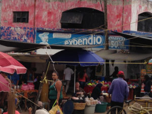


Fig. 1 – San Martin das Flores in the state of Jalisco, Mexico. Sixteenth-century Spanish settlement turned into slums by the uncontrolled growth of Guadalajara.

encourages the formation of distinct strips of anti-polar construction. Moreover, one should take into account the fact that the greater or lesser marginality of areas of potential city expansion does not depend on their distance from the centre, but rather on complex factors, in¬cluding their accessibility, which has relevant influence, due to the very nature of American cities.
This situation leads to an early division of properties and a change in the size of building lots, smaller near areas of expansion but with a significantly higher value. The development of fringe belts here is therefore less continuous and often opposite to development in radial strips, sometimes following a linear, though discontinuous, form of expansion along transport arteries and, at other times, a growth of ‘clusters’ scattered throughout the territory, depending on a method intrinsic to the market-driven rationale of intense speculative activity and few town planning regulations.
The distance from one’s workplace, often located in the CBD or at its edges, combined with the extensive use of private transport and the formation of associated large-scale infrastructure, contributes to the complexity of this multi-faceted model of growth that is so hard to generalise. Thus the concept of the rural-urban fringe (R-U fringe) emerg¬es, understood to mean the transitional zone that, in Western cities, indicates a discontinuous territory and a contradictory landscape on the border between city and countryside, made up of extensive areas featuring specific, recognisable characters. One character that is usu¬ally identified with R-U fringe is due to the particular condition of its inhabitants, who live there despite not being part of the place either economically or socially (Herington, 1984). It is, moreover, a structural phenomenon linked to the inexorable growth of the urban population, which has for some time now overtaken the rural population (over 54% in 2017), with a percentage growth that seems relentless. This explains the renewed interest in the concepts of ‘fringe belt’ and ‘R-U fringe’, which still seem suited to interpreting the new, uncontrolled phenomena (that are, nevertheless, dynamic and innovative) of the market-led expansion of cities, where new anti-polar structures are often placed beyond the immediate administrative limits not only of large cities but also of small towns, in peri-urban areas that are hardly regulated, occupied by a combination of detached single-family houses and large entertainment complexes, commuter districts and noisy small businesses that cities push to their margins, areas used by undertak¬ers and warehouses of all kinds, shopping malls and venues for large events, concerts and festivals along the edge of farmland. The fact that concepts that have now become traditional, such as those of the fringe belt and R-U fringe have, for some time now, been placed at the centre of design project instruments for areas in urban expansion, succinctly tackling spatial as well as political and social problems, is proof of the attempt to establish the latest town planning frontier, limiting the fragmented city (Gallent, 2006).
However, we cannot deny that the idea of limits, which once con¬stituted one of the pillars of urban studies from the post-war period on, is now definitively in crisis, together with that of a perimeter, which was not only used as a planning tool but also as a mindset, allowing us to establish distinctions and borders.
Nevertheless, I believe that architects and town planners are not al¬lowed to accept reality as it is (contrary to the aesthetically pretentious movement that has recognised in the disintegration of every order the representation per se of the modern world). Often disorder, if ob¬served methodically, contains its own explanation, multifarious aspects of manmade principles that can be recognised and analysed rationally.
In any case, the model used to interpret and critically explain the phenomena of urban expansion is not just a scientific tool: it is also knowledge in action, it contains a design project. I believe we need to ‘designedly’ seek out the form of cities that expand, even in their seem¬ingly chaotic, formless parts (Strappa, 2012).
This book compares and contrasts a number of essays on urban expansion that examine case studies located in various different geo¬graphic areas: from Europe to Asia, from North to South America.
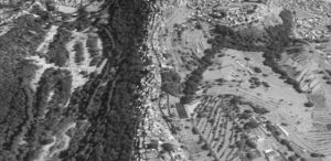

Fig. 4 – Spontaneous ridge routes in the expansion of Mexico City.

It is not, however, just a comparison of urban samples. What interests the editor is to compare interpretational models derived from experi¬ence that come under the umbrella of Urban Morphology, developed in different cultural contexts that nevertheless share the conviction that the form of a city, even in its most seemingly chaotic incarnations, can be interpreted rationally and contains the seeds of future change.

References
Caniggia, G., Maffei, G.L. (1979) ‘Composizione architettonica e tipo¬logia edilizia 1.Lettura dell’edilizia di base’ (Marsilio, Venezia).
Conzen, M.R.G. (1960) ‘Alnwick, Northumberland: a Study in Town- Plan Analysis’ (Institute of British Geographers, London).
Gallent, N., Andersson, J., Bianconi, M. (2006) ‘Planning on the Edge’ (Routledge, London).
Herington, J. (1984) ‘The Outer City’ (HarperCollins, New York).
Lammers, D., Pereira Roders, A., Van Wesemael, P. (2016) ‘Radial fringe belt formation’, Proceedings of the 22nd ISUF Conference, Rome 2015 (U+D, Rome).
Muratori, S. (1963) ‘Architettura e civiltà in crisi’ (Centro Studi di Storia Urbanistica, Roma).
Strappa, G., ed., (2012) ‘Studi sulla periferia est di Roma’ (FrancoAnge¬li, Milano).


MORPHOLOGIE ET SYNTAXE DES MILIEUX BÂTIS

Université Laval – École d’architecture |

MORPHOLOGIE ET SYNTAXE DES MILIEUX BÂTIS 

Plan de cours – Session Hiver 2018

Responsable : Professeur Giuseppe Strappa
Assistant : Arch. Vincenzo Buongiorno


Ce cours porte sur les fondements théoriques et les outils cognitifs et méthodologiques propres à l’étude des processus de formation et de transformation des milieux bâtis. Il traite de l’analyse de l’organisation formelle et spatiale des tissus urbains, des villes et des territoires et vise l’acquisition d’une méthode de lecture morphologique permettant l’évaluation de la qualité de la forme urbaine et la définition d’objectifs pour sa requalification.

PROGRAMME MORPH. modele_EAUL_H18_20171213

Documentation et communications : https://monportail.ulaval.ca/accueil/


THE TOWN AS AN ORGANISM: READING TRANI AT DIFFERENT SCALES


by Giuseppe Strappa, Matteo Ieva, Marina Dimatteo

in : G.Strappa, M.Ieva, M.A.Di Matteo, La città come organismo. Lettura di Trani alle diverse scale, Bari 2003.

The main task of this book is to demonstrate a method of reading built landscape based on the fundamental assumptions that the different reading scale of built landscape (building, aggregate, urban, territorial scale) are linked between themselves by the notions of organism and type and that the tools of typological-processual analysis are not subordinated but complementary to the traditional tools of reading city and territory such as the urban history or archaeology.
At this regard the case study of Trani (see tav 2 pag. 68) seems particularly suited for the task as few evidences of the urban form is known before the IX century and any formation process regarding the original settlement type and fabric has to be investigated mostly trough typological interpretations.
Even the research about Trani is still in progress, we believe useful to propose some working hypothesis (see tavv. 9a,9b,10 at pages 76,77) about the ancient origin of the medieval structure of the town inside the Longobard city walls of the XI century and of Federician ones of XIII century. A matrix possibly derived from the ancient Turenum reported on Tabula Peutingeriana.
The central area of the old town, in fact, can be regarded as planted on a matrix route (actual via Beltrani) polarised by the specialised area of the Cathedral and the Episcopal Palace, which organises, with remarkable regularity in dimensions and pertinent strips, an orthogonal grid of routes (see tav.5b at page 71).
A second route, now disappeared and parallel to via Beltrani, whose urban role we will see later, can be recognised as prosecution (now infilled) of the narrow path of actual via Leopardi (Carlone 1981).
The regularity of the urban structure around; a centralising axis and the remarkable differences in the urban aggregates in the south east from the ones in the north west areas, induce us to think, more than a spontaneous hierarchization of the different routes, to some form of original planned grid from which the medieval structure has taken place through a general up-dating of building types and an extensive substitution of special building, but also trough a substantial preservation of the ancient structure of routes, even if conditioned by progressive transformations in the settlements and territorial order, as the formation of the Jewish quarter of La Giudecca, evidently planted on the spontaneous routes linking the coastal viability.
It must be considered that the crisis followed to the fall of Roman Empire of Occident in V century, the gothic war in VI century, the Longobard conquest in the VII one, had as a consequence the decay of most of urban and territorial structure in Apulia and that the reorganisation started in VIII century trough the Longobard gastaldati and, in the following two centuries, Byzantine administration, using tools and scale comparatively modest, must have been founded on the extensive remains of the ancient urban heritage.
The dialectic between planning as result of “critical conscience”, and adaptation as product of “spontaneous conscience” , is so continuos in the relationship between ancient city and late-ancient or middle age transformations, that it is possible to recognise in the different passages a remarkable level of typicality.
Just this typicality allow us to read single phenomenon as part of a more general process of changing of characters in Italian cities.
The cartography employed in the research consists in:
– contemporary and 1873 cadastral maps at 1/1000 scale;
– survey of building structures carried out by Trani Administration in 1989 at 1/200 scale;
– survey of building structures carried out specifically for the research, partially still in progress;
– 1869 IGM (Istituto Geografico Militare) maps at scale 1/50.000 and contemporary (1938 and 1963) IGM maps at scale 1/25.000;
– historical maps.
A chronology derived from documents of historical events compared with transformations in urban form of Trani has been also employed.
The following synthetic description starts from the smaller scale of the building till the territorial scale

BUILDING ORGANISM SCALE

A – BASE BUILDING
The base building of Trani is composed by an aggregate of roughly squared cells of average dimensions ranging from 4 to 6 meters with modular (half o double size) variants. The construction is in local stone for vertical walls with masonry vaulted floor at ground and wooden-beam at successive floors.

The wide quantity of types in aggregation of cells can be reconducted to two main basic types of houses:
• two cells row houses, with numbers of synchronic variants by position and diachronic variants due to the infill of pertinent area, increasing in highness, specialisation of ground floors, sometimes as loggia mercantile (see fig.7 at page 114 and tav.70 ata page 135). This peculiarly medieval type of housing, largely spread in all northern¬central Italian peninsula, is not so common in Apulia, where it seems imported, at least in its “mature” form trough exchanges with northern areas consequent to Longobard and Federician domination (the exemplary case of the foundation town of Manfredonia can be considered)
•     courtyard houses, in which cells are aggregated around a common distribution space originally open. This type, derived from the “consumption” of the roman domus at the end of a long typological process (see tavv. 1,2,3,4 at pages 98-100), is extensively employed in Apulia towns (Bitonto, Polignano, Conversano, Altamura etc.), although with a south east common orientation instead of the usual southward one. The same toponimy of the places (curte from Latin curtis , claustro from claustrum) indicates their ancient direct or indirect origin. From the cadastral maps of Trani is possible to read as those aggregations are often contained within modular enclosure, with the actual different ownership often roughly obtained trough partitions of an original modular one.
Both types can be found, largely transformed,. in the Trani urban fabric: diachronic variants and sometimes multi family fusion (originating thus new types) of old single family houses for the row houses; pseudo row house for the courtyard houses.
A first, important consideration for the reading of the city, can be made observing the diffusion of the different types:
– the first type is individuated at the margin of the central area, outside and inside the Longobard perimeter and in the Federician expansions, with the remarkable exception of an homogeneous aggregate in the S. Martino area (see tav.25 at page 89);
– the second type appears to be concentrated in a roughly squared area with sides of 150, 200 metres.
This consideration allows us to put forward a first hypothesis (which will be supported by other dates) on the structure of the ancient town, occupied by the “substratum” courtyard type and cleared “in negative” by the row houses perimeter. In the S. Martino area we must grant the presence (which also will be supported by other dates) of an extensive open area free from private building in which a tissue based on up-dated types had developed.
B – SPECIAL BUILDING
The first religious buildings, mostly convents and related constructions, are situated along the Longobard perimeter. As usual for building types as monasteries, which require large space to develop, those constructions occupies initially anti polar.positions in relation to urban route (but often nodal in relation to territorial routes) to become, with the expansion of urban organism, urban poles of successive expansions (see tav.79 at page 143).
In XII century appear to be edified:
•     westward, the monasteries of    S. Paolo and S. Giovanni and the church of S. Giovanni e Paolo
•     southward, the church of S.Salvatore (on the route for Andria); the church of S.Andrea and Toma (close to Porta Nova doorway and the route node at the intersection between the carriage coastal road and the route connecting the productive hinterland), with the church of S. Caterina immediately inside the door and the small church of S. Agata in even more central position, but anyway external to the area of orthogonal routes;
•     eastward, corresponding to Porta Antica doorway, the nuns convent of    S. Trinita, the Ognissanti church and a number of small churches close to the port;
•     northward the special complex of the Chiesa Maggiore, church S.Giovanni Evangelista and Palazzo dell’Arcivescovo;
•     in even more anti polar position a number of special areas and buildings, most in Colonna peninsula (the churches of S. Antonio, S. Vito, S. Giovanni de Penna, the Jewish cemetery) and close to the route node corresponding to the cross of Flumicellus flood (S. Maria Cavense, SS.Sergio e Bacco, S.Giorgio, S. Maria de Dioniso, S. Trinità, S. Basilio)
•     single and remarkable exception to the general anti polar position of special buildings is the monastery and church of S. Martino, situated in the.very centre of the area of regular grid routes. This is not only the oldest monastery in Trani, but its construction must date far before the year 1075 evidenced by documents, as the architectural characters and the building technique employed would rather indicate an origin in X or even IX century (Ronchi, 1988).
The area of the ancient settlement can be derived from the analysis of special building placement: it clashes with the area of regular routes around whose margins, typically, most of special buildings are displaced.
The exception of the site of S. Martino complex confirm the hypothesis of a large public area for the construction of special building available after the fall of central administrative control.
The type of palazzo building must be considered (see tavv. from page 142 to158), in general, apart from the other special buildings for their close relation to base building. In Trani, in particular, palace type has a late formation in XV-XVI century, with large construction obtained by fusion of a number of cells of base building on ‘the main matrix routes polarised by special areas of great civil and religious value: most in via Beltrani (via Duomo), connecting the nodal area of Porta Nova with the Cathedral and the fair area. Here are first settled the Rogadeo, Palagano, Bonismiro palaces and, later on, the most important palaces of Trani, giving origin to a real “special tissue”, in the same manner of other prosperous maritime cities as Genoa and Venice .
Houses of other important families as de Boctunis, de Cuneo, de Agnete and, again, Palagano also settled in via Ognissanti, connecting the route node in Flumicellus area , trough the Giudecca quarter, to the area of S. Marco church and Caccetta, Sifola, Filangeri palaces.
In the palazzo type individuated in Trani is quite constantly possible to recognise the re-aggregation of cells, originally belonging to single family houses, in a new unitary organism. The unified facades give clear evidence of the intention to form a “rhythmic wall” (Caniggia, 1979), but the irregularity in the distance between windows, often the lack of a true centralising axis and, instead, the recognisable presence of the original dividing lines, indicate the derivations.
The level of typicality of those palaces is very low in comparison with the examples of other areas as the Roman, Florentine or Venetian ones. Only few characters are in common: the aggregate of cells around a common distribution space in which the main stair is placed; the dimensions of the front walls, based on the modules (often double) of the courtyard house from which seams indirectly to be derived.
The origin of via Beltrani palaces, anyway, demonstrate as the area was previously occupied by base building, probably by domus type houses. With increasing social and economic divisions this type has generated both, as in Venice (Maretto, 1986), the palace type and the pseudo row houses, the first as increment, the second as decrement of an originally common pattern of enclosure.

AGGREGATIVE ORGANISM SCALE
To recognise the shape of a possible planned urban structure we need to use, further the analysis based on the route hierarchy and pertinent strip, the notion of tissue as type of aggregate subjected to typical processual transformations, in our case from ancient to middle age city. We need, in other words, to investigate in their typicality the phenomena of “medievalization” of ancient urban fabric. These phenomena are in general mostly related to the public spaces infilling process by private ownership (Caniggia, 1963 and 1976) owing to the decay of administrative control started in late ancient period.
They are distinguished by three constant aspects, present also in our case:
•     the deformation of planned orthogonal alignments (see tav.4b at page 70);
•     the infill of ancient public spaces, specially if partially opened, trough new special building or new spontaneous base building fabric recognisable for the lack of planning of the related routes (see tav.8 at page 75);
• the formation of non planned fabric along, the spontaneous curvilinear routes connecting the doorway of the wall (see tav.6 at page 74, tav. 22 at page 88 and tav. 30 at page 91).
It is particularly useful the analysis of alignments of masonry structure at ground floor distinguishing:
– orthogonal alignments which could be related to ancient planned structure;
– curvilinear alignments oriented from alignments of planned city which could be related to progressive advancing of buildings front walls as for infill of routes free spaces;
– diagonal alignments opposite to the general orthogonal grid which could indicate new medieval fabric in evidently free spaces.
All those alignments had been recognised in Trani and drowned on tables which demonstrate clearly:
• the presence of an orthogonal grid of wall alignments in the inner medieval town which, for exactitude and constancy inside the supposed ancient city, can’t be other than planned;
• the presence of orthogonal routes “medievalized” trough the advancing or deformation of wall front with particularly extensive and evident infill in the two actual roads of vico Santo Nome e via Beltrani, which can be related, for dimensions and role inside the urban fabric as the two main access routes to the ancient city: the first on the axis of via praetoria, and the second as the other main route on the counteraxis of via principalis as in typical roman planned city. Those road, from which planned routes are originated, must had a behaviour as matrix road in middle age transformations, originating different aggregates owing to the different orientation of the original courtyard houses:
per strigas on via S. Martino, via Leopardi, via Sinagoga
per scamna on via Carlo d’Angiò, via S. Giovanni, via Romito, not by case transversally connected by vico (or narrow road) S.Agata e vico S. Gaetano).
Another important, even if secondary axis, was on the alignment of actual via Leopardi. This route could have had a connecting role comparable to that of via quintana in roman pattern.
The “medievalization” process appear to be confirmed from the presence and continuity of many internal wall alignments, even in the extensive transformations occurred. The unusual proximity @ of those wall alignments to the outer walls, mainly in correspondence of block corners, can’t be in fact explained neither as constructive nor distributive anomalies.
•    the presence of a large public area occupied by structures as peristilia or portici, in the site of the S. Martino complex proved, resuming what previously asserted, by:
1) the base building types employed in edification (row house in courtyard type contest);
2) the special building types employed in edification (the now disappeared monastery, individuating a typical anti polar type);
3) the diagonal alignments corresponding to new unplanned fabric
•    the position of the doorway polarising unplanned perimeter curvilinear routes (Caniggia, 1976)

URBAN ORGANISM SCALE
From the previous considerations, linking together in an organism the different base and special aggregate individuated in Trani, it is possible to propose a well-founded hypothesis about an ancient matrix of the actual town derived from the typical form of roman planning, based on the formation of two main orthogonal axes polarised by the forum area, with base building based on a courtyard house type, in our case lightly less in frontal dimension (16 metres) than the usual half actus , aggregated in “closed” or “opened” series and separated by ambitus. An original nearly squared city wall perimeter, measuring about 150/200 metre in side, can be argued from the previous considerations.
The city wall thus contained, typically, the higher part of the peninsula and were quite regular in shape and symmetrical on the side of the main access , as usual in roman planned city (see tav.7 at page 74) as Firenze, Genova, Como (Caniggia, 1976; Strappa, 1987) while they rotate in the direction of the port in the southern part, perhaps also conditioned by previous routes, orienting the courtyard houses fabric inside .
The ancient city wall corner and the position of the doorways are legible trough the curvilinear routes analysis. This perimeter of original city wall disappeared probably at middle IX century, at the time of Saracen domination over Bari
In the north-eastward side can be supposed both:
– the prosecution outside the perimeter of the actual via S. Martino and via Leopardi routes (now rotate in direction of the commercial area of the port) ;
– the presence of a single central doorway connecting the Giudecca area, in the site of the two main synagogues , at the end of the diagonal route of S. Martino area. The site of this doorway, to which is for the moment impossible to attribute a date, is confirmed by the discovery of a route, now infilled inside a block between via Giudea and vicolo Giudea. The direction of this route, pointing exactly the place of the supposed door, is confirmed from the corresponding alignment of walls in the following block.
Having assumed as matrix the type derived from roman planned town, it remain unsolved the problem of stating to which type of urban organism it can be referred. The term castrum , the dimension of which are not anyway reached , related to Trani in documents from IX century is in fact employed with the meaning of a fortified settlement which don’t reach the dignity of a civitas..
It is not allowed, also, to relate to other type of roman colonisation towns as the coloniae latinae, far wider in dimensions , neither to coloniae viritanae as the complete list of them (35 in all) is asserted by literary evidences.
An urban pattern, even if of later date , not far different from coloniae maritimae founded first on Tyrrhenian coast and then on the Adriatic ones in II century B.C. could be proposed.
This hypothesis could be supported by the contained dimensions of the original nucleus which must not had exceeded 70 courtyard houses: not far from the small initial size of about 300 farmers with perimeter around 150/200 metres in side of coloniae maritimae . Nevertheless the modest size of public spaces of the latter, consequence of the lack of administrative autonomy, don’t allow too close comparison with Trani, where the forum area seem to had been relatively wide .
Our proposed interpretation of the ancient urban organism had been, anyway, traced on the data deduced from the actual structures referred to some general characters common to roman planned town, leaving unsolved the question if this urban order is the first one or if it has been reached starting from an even precedent settlement .
The reading of urban organism of Trani is still far to be definitive, as it is intelligible from the number of problems still unsolved and for the coexistence, sometimes, of a double hypothesis (as for the access to oriental wall), resolvable probably admitting the diachronicity of two different orders reached in different historical phases. A further evidence of the original ancient pattern of Trani could come from the studies of the level of routes and construction: it seem clear that also in Trani, as for many ancient cities, a general vertical “growth” of road level has occurred, proved by:
•    the ground level of many houses, lower then the level of the related route;
•     the presence of underground floor when the ground level of houses is higher than the level of the related route;
•    the original level of the area of the supposed forum, where the S. Martino church had been founded at an average level two metres lower than the actual road level;
•    the construction level of the buildings below the Cathedral: the S. Maria church, probably dating to V century, is founded on the ruins of a previous Early Christian church 130 cm below the level of actual crypt;
•    the higher level of via Beltrani, below which recent excavation work has revealed no traces of previous structures, in comparison with the other planned route, which confirm its role of matrix route, typically following a light ridge coming from inland territory.
If we compare the evolution of city wall we can note how the urban structure is the result of a territorial dialectic between inland routes structure and coastal ones, which can be understood reading the built environment at a larger scale.

INTRODUZIONE ALLA NOZIONE DI ORGANISMO

Giuseppe Strappa

Le caratteristiche di un organismo architettonico possono essere individuate nel termine “vivente”. Nella vita, cioè, che lo pervade: che lo genera, che lo trasforma, che ne segna l’inevitabile decadenza.
L’organismo costruito, dunque, possiede una propria struttura organizzata che si rinnova nel tempo. L’uso stesso degli edifici e dei tessuti, il loro consumo, richiedono un continuo aggiornamento, dalla prima costruzione fino alla loro sostituzione. Questo carattere autopoietico deve fare, i conti, soprattutto nel caso dell’architettura (meno dell’edilizia), con l’apporto critico dell’autore, impedendo il suggestivo paragone, che ha affascinato e condotto in errore generazioni di architetti, con gli organismi naturali. Se non c’è dubbio che, nel rapporto che nel progetto si stabilisce tra soggetto e oggetto, quest’ultimo contenga suoi propri caratteri “organici”, portato dell’impiego degli spazi nel corso della storia, del patrimonio di tecniche costruttive, dell’esperienza estetica che si è consumata nel tempo in tutte le scale del costruito, è anche vero che noi abbiamo ormai consolidato una superficiale critica di architettura dove innovazioni radicali e cambiamenti improvvisi provocano un’attenzione di gran lunga maggiore delle permanenze, dei sostrati profondi della vita che permea la realtà costruita e che costituiscono il suo carattere più concreto e meno evidente. Nell’età della globalizzazione e degli organismi geneticamente modificati è noto come non sia facile coltivare nozioni come quella di processo formativo, di area culturale, di organicità alle diverse scale (degli edifici, della città, del territorio).

Ma cerchiamo di vedere il problema con occhi nuovi. Gran parte del pensiero sull’architettura contemporanea pone al centro del progetto la logica della globalizzazione. Il termine indica (nel suo senso generale cui corrispondono molte interpretazioni diverse, spesso in contrasto tra loro) l’attuale internazionalizzazione della produzione e dei mercati, con la relativa ricaduta nell’accelerato trasferimento di tecnologie, circolazione di capitali, migrazioni di persone. Questo fenomeno, che Anthony Giddens definisce sinteticamente come intensificazione delle relazioni planetarie, che finiscono per incidere indubbiamente sul carattere della cultura contemporanea, ha ricadute evidenti sulle condizioni in cui opera l’architetto. E tuttavia esso è stato ampiamente mitizzato, accettato come condizione alla quale non è necessario opporsi (come dato del problema) ed anche come rivoluzione inedita nella storia della civiltà occidentale, quando in realtà si tratta delle conseguenze estreme di un processo che ciclicamente attraversa l’intera storia dell’economia e della cultura. Trasferendo le condizioni del mercato e della tecnologia alla cultura, secondo paralleli non sempre dimostrati e dimostrabili, gli architetti inseguono, da tempo, l’ ipotesi di un pensiero generalizzante ed astratto, perdendo la capacità di analizzare la realtà costruita nella concretezza dei suoi contesti plurali che costituiscono, nel loro insieme, la condizione storicamente determinata all’interno della quale ogni progetto, unico ed irripetibile, si colloca. All’architetto, per statuto, non è consentita la pura constatazione, l’adeguamento alla condizione contemporanea: ogni progetto, per aspirare alla durata, deve contenere, insieme, quel tanto di inattuale e quel tanto di utopia che costituisce il sale del suo apporto critico alla modificazione della realtà costruita. Ed è singolare che, in un mondo in cui l’architettura sembra chiamata a rinnovarsi incessantemente, in realtà essa finisca per voler confermare senza critica, puntualmente, le proprie condizioni al contorno. Se si pensa ai contenuti etici di proposte come quella del Movimento moderno, ci si accorge di come poche epoche, dal XIX secolo in poi, hanno mostrato una mancanza tanto evidente di opposizione ai valori invalsi come la nostra, una tanto inerte accettazione dei portati della città liberista, informe e senza regole D’altra parte si fanno sempre più evidenti le istanze di cambiamento verso un saggio impiego delle risorse, verso il loro organico coordinamento con la vita dell’uomo, che si vanno trasformando, da esigenza imposta dalle necessità nei secoli scorsi, in scelta cosciente e, forse, in valore. Nella generale confusione delle cose che ha coinvolto la nozione di organismo, un ruolo fondamentale ha svolto, infatti, la recente condizione di smisurata disponibilità di risorse, dell’inedita condizione di affluenza che caratterizza alcune società del mondo occidentale, con i relativi fenomeni di estesa dilapidazione di ricchezza. La liberazione dai vincoli imposti dal bisogno, che mettevano in luce con chiarezza i rapporti di elementare necessità tra le cose, ha finito col produrre, già ora, i primi sintomi del decadimento dei nessi che contribuiscono a spiegare perché e come le parti di un edificio (ma anche di una città o di un territorio) si conformino, come sviluppino rapporti di congruenza tra gli elementi componenti. Nel quadro di una generale crisi che induce a sostituire la quantità di beni prodotti alla qualità dell’ambiente antropizzato (per usare un termine desueto, all’armonia tra le parti del mondo costruito), il principio razionale ed estetico di appropriata proporzione dei mezzi rispetto ai fini da raggiungere ha progressivamente perso il proprio ruolo fondante nella pratica progettuale e con esso l’etica del buon uso delle risorse che coincide, in larga parte, con l’arte del saper ben costruire.


Ma la nozione di organismo aveva già incontrato, peraltro, l’avversione ostinata dell’ideologia del Movimento moderno (o meglio dalla sua definizione consolidata dalla storiografia ufficiale). Questa ostilità in realtà fa riferimento ad una più generale koiné di pensiero che caratterizza la modernità, della quale l’idea di progresso sembra essere il portato più evidente. La moderna idea di progresso, recentemente messa in crisi da interpretazioni meno schematiche dello sviluppo storico, sembra infatti individuare un movimento lineare in una sola direzione: un movimento progressivamente accelerato, seppure discontinuo, verso una meta essa stessa continuamente progrediente. Le forze storiche che si autoeleggono come acceleranti questo processo si riconoscono in una scala di valori che legittima il proprio rapporto oppositivo con la cultura ereditata fino ad arrivare a ritenere l’opposizione (l’innovazione radicale ed antitetica, rivoluzionaria nei confronti della continuità storica della quale la nozione di organismo era il portato diretto) valore di per sé. L’intera età moderna viene così intesa dai pionieri della modernità in una dimensione di eroica reazione alle età antecedenti, dove la storia viene letta per fasi di successivi superamenti, reprensibili arretratezze, recuperi. Essendo la sua meta costituita, inevitabilmente, da condizioni migliori rispetto allo stato di partenza, l’idea di progresso assume in età moderna carattere salvifico, religioso: distinguendo adepti, profeti, schieramenti.
Quella di organismo è, in realtà, una delle nozioni fondamentali degli studi sulla progettazione e dello stesso progettare: su di esso può essere basata la lettura, la critica (cioè la lettura e, insieme, le scelte che ne derivano) il modo di operare dell’architetto.
Occorre dire subito, per allontanare equivoci invalsi, che l’idea di organismo non implica alcun determinismo meccanico, ma rappresenta la manifestazione del legame molteplice che unisce, nella concezione dell’artefice, tutte le componenti che concorrono a determinare l’esito finale dell’architettura: il costruito.
Questa nozione percorre, in maniera latente od esplicita, tutta la storia della teoria dell’architettura: non solo informa gran parte della città reale, anche contemporanea, ma è anche capace di coglierne le nuove istanze.
Leon Battista Alberti sosteneva che occorre disegnare gli edifici imparando dalla semplicità della natura, intendendo per natura gli organismi viventi . E’ noto anche come molte ricerche dell’architettura rinascimentale fossero originate da questo rapporto di affinità, tradotto, a volte, in maniera diretta in edifici antropomorfi o zoomorfi.
Il corpo umano è uno tra gli esempi proposti con maggiore frequenza: ogni sua parte costituente (organo) è necessaria all’altra e concorre in modo esemplare alla vita dell’organismo. Il legame, evidente, ma non sempre chiarificatore, con gli antecedenti della trattatistica rinascimentale verrà tuttavia accuratamente evitato nel seguito per gli equivoci che possono essere ingenerati dal rapporto tra architettura e scienze della natura.
Così concepita, l’idea di organismo, di struttura di parti lentamente evolventesi per mutazioni successive (l’idea di evoluzione sostituita a quella di rivoluzione) sembra portatrice di valori arcaici, inutilizzabile. La macchina per volare ideata da Leonardo osservando il volo degli uccelli era una potente intuizione poetica ma l’uomo non ha mai volato con un congegno ad ali battenti. Solo componendo, attraverso la ragione, la pressione esercitata dal volo animale nei vettori verticali della portanza prodotto dall’ala fissa e in quello orizzontale prodotto dall’elica, l’uomo ha prodotto l’aereo.
La definizione di organismo che utilizzeremo (e quella di organicità che ne deriva) ha ben poco a che vedere, dunque, con le matrici naturalistiche utilizzate attraverso l’imitazione delle forme minerali, vegetali e animali nel corso della storia dell’architettura, dalle citazioni fitomorfe gotiche ai tanti “ordini rustici”, alle sperimentazioni manieriste dei Wendel Dietterlin, Philibert Delorme, Sebastiano Serlio, Federico Zuccari, né con la moltitudine di interpretazioni antropomorfe e riduzioni antropometriche della realtà costruita (dagli edifici, alle città alle cosmogonie ) prodotte ininterrottamente dal ‘500 fino alla corrente dell’architettura organica che ha percorso trasversalmente la vicenda moderna.
E in realtà, a ben guardare, la stessa etimologia del termine organismo, nel senso attribuitogli dagli studi tipologici, è, in gran parte moderna. Si rapporta infatti al più recente termine, sconosciuto prima dell’ Illuminismo, di “organizzazione” come legge che presiede al coordinamento degli elementi tra loro. Va notato, per inciso, come in realtà il termine organizzare esistesse già ai tempi di Dante, ma nel significato letterale di “formarsi degli organi”. La trasformazione del suo significato nel tempo indica la progressiva estensione dell’idea di organismo ad altri ambiti delle attività umane per i quali andava insorgendo la necessità di coordinamento. Mutuato dal francese, nel Seicento, il termine entra anche nel linguaggio scientifico italiano prendendo il valore di “ordinare, disporre” e nel 1649 il Malpighi definisce, modernamente, organizzazione il termine che indica l’insieme di parti che collaborano ad una stessa funzione.
La definizione di organismo può essere introdotta per gradi, deducendola dapprima da constatazioni elementari, restringendone poi il significato e chiarendo i molti equivoci che ad esso sono stati associati nel corso della storia, anche recente, fino a raggiungere l’esattezza dei termini. Cercando di comprendere, cioè, la logica formativa interna agli edifici considerati nella loro realtà fenomenica e arrivando a stabilire, per analogia, alcuni loro caratteri comuni in grado anche di fornire, in modo inizialmente intuitivo, la nozione di tipo.
Usato, infatti, con le opportune cautele, lo strumento dell’analogia, operando attraverso raffronti con quanto della realtà è evidente, appare particolarmente fertile negli studi che hanno fini interpretativi, tendendo alla sintesi di dati che in architettura si presentano nel loro carattere parziale e frammentario.
Questo strumento è anche utile a fornire, in prima approssimazione, l’idea di complessità contenuta nella definizione di organismo e, insieme, degli strumenti possibili per sciogliere tale complessità attraverso la comprensione delle ragioni interne che conformano prima, e legano poi gli elementi tra loro. Per questo motivo proporremo la ricostruzione del processo formativo di alcuni organismi architettonici esemplari (leggendo gli edifici ed il modo in cui vengono costruiti, ragionando sui meccanismi che ne hanno originato gli interni rapporti di necessità) e deducendo da questi studi le prime nozioni fondamentali e definizioni teoriche .
…………..


Les architectes travaillent pour une autre planète?


Les architectes travaillent pour une autre planète?*

                                                                     Editoriale U+D  5/6

di Giuseppe Strappa

Si arriva alla Città della Cultura di Santiago de Compostela attraverso una via dalla sezione grande quanto quella di un’autostrada, percorrendo un’ampia curva intorno alla collina di Monte Gaiàs finché appaiono in lontananza, dietro un gigantesco parcheggio, le nuove opere disegnate da Peter Eisenman.
Le notissime griglie digitali del progetto, in attesa nella memoria, si sovrappongono inevitabilmente alle forme reali, come se comparissero veramente sulla retina, e riportano le cose, per un attimo, a figure note.
Ma quando ci si avvicina, le costruzioni mostrano un aspetto inatteso, un’anticittà che si presenta, davvero, come il negativo della vicina città storica. Non, tuttavia, per l’overlapping geometrico previsto dall’architetto, dove il pattern delle vecchie strade di Santiago si sarebbe dovuto sovrapporre a quello del luogo e ad un reticolo cartesiano ordinatore. Per un motivo molto diverso: dove nel vecchio centro tutto è cordiale e rassicurante, tra quinte di pietra solidamente serene e piazze solari, su questa collina tutto sembra provvisorio, come sull’orlo di una catastrofe, o dopo un’eruzione, o un sisma che ha deformato le costruzioni e distorto il suolo. In una forma maestosa e senza misura, peraltro, che non ha nulla dell’esattezza del progetto iniziale e sembra attingere ad uno splendore silenzioso e remoto, di rovine antiche.
E in rovina sembra pure il cantiere abbandonato del Palazzo della Musica.
L’ architetto newyorkese ci ha regalato uno spettacolo sontuoso e terribile. Vengono alla mente gli spaccati assonometrici eseguiti da Joseph Gandy per la Bank of England di Soane che sembrano alludere a una costruzione in disfacimento,
E vengono alla mente gli spazi dilatati del parlamento di Chandigar, dove l’essere umano si fa minuscolo e si perde tra le ombre dei grandi volumi sotto la luce.
Ma bisogna fare il grande sforzo di tornare alla ragione, di staccarsi dall’eterna malia del romanticismo in agguato: non siamo nelle capitali del Punjab; non c’è, qui, alcun orgoglio nazionale da esprimere con la retorica dell’architettura. Sotto di noi, a tre chilometri di distanza, sebbene l’architetto l’abbia nascosto alla vista, c’è un piccolo nucleo di poche migliaia di abitanti dove si custodiscono i resti dell’apostolo Santiago, Sant Jago, San Giacomo: uno dei centri della cristianità, meta di ferventi viaggi spirituali che alimentano, anche, un lucroso turismo religioso.
Bisogna resistere al fascino decadente delle rovine (e all’aura che certamente il nome dell’autore conferisce loro) per andare alla sostanza delle cose. Le quali hanno anche un loro valore indipendente dai processi che li generano.
Se si ascoltano gli architetti del luogo e si fanno due rapidi conti, si scopre la vera dimensione del dramma collettivo di una città che ha creduto nel potere salvifico dell’architettura e si ritrova, ora, di fronte a problemi più grandi di lei. Più grandi finanziariamente, con il costo delle opere quadruplicato negli anni e del tutto sproporzionato rispetto ad una popolazione che non arriva, nell’intera Galizia, a tre milioni; più grandi fisicamente, con un centro culturale più esteso dello stesso centro storico; più grandi dal punto di vista gestionale, con la nuova struttura che divora tutte le risorse disponibili togliendole alle istituzioni culturali cittadine, compreso il Centro di Arte Contemporanea costruito da Alvaro Siza, pienamente inserito, fino ad ora, nella vita della città.
Progettato in un periodo di crescita economica e nel clima di competizione tra municipalità che ha portato al rinnovamento di molte città spagnole, la Città della Cultura è il prodotto ritardatario di un “effetto Bilbao” sviluppatosi in un contesto storico e culturale del tutto diverso.
E anche quando era ormai evidente che questo intervento faraonico (il cantiere più grande della Spagna) con il deterioramento delle condizioni economiche e una disoccupazione al 20%, sarebbe stato anacronistico, l’ex ministro franchista Manuel Farga, presidente della Regione galiziana, poi spalleggiato dal suo successore, Alberto Núñez Feijóo dello stesso Partito Popolare, lo ha strenuamente voluto per lasciare il proprio segno prima di lasciare la politica. Aveva convinto, Farga, i propri concittadini dell’idea che un complesso culturale di scala planetaria, come il Museo di Arte Moderna di New York, come l’Opera House di Sidney, potesse planare sulle colline della Galizia a portare progresso e modernità. Ora ci si rende conto della dimensione del problema e i lavori sono quasi fermi, ma è troppo tardi per tornare indietro e le strutture già costruite, deserte di visitatori, vanno comunque alimentate con iniziative costosissime.
Così, sulla collina di Monte Gaiàs, il mondo apparentemente nuovo di intersezioni, attraversamenti, sovrapposizioni, deformazioni del progetto generato da una logica digitale dove la geometria sembra controllare tutto, si scontra con la realtà e mostra per intero le proprie radici ancora Beaux-Arts sviluppate, tuttavia, all’estremo, fino all’astrazione che libera dal contingente.
E vacilla la cortina mediatica stesa a protezione di quest’opera celebre per il procedimento d’invenzione che impiega. Sarà poi vero che i percorsi sono traducibili in layer immateriali e che i layer sono sovrapponibili tra loro e che questa sovrapposizione genera il progetto e che questo si fa, infine, costruzione? Secondo un metodo indimostrabile. Che, anzi, non ha bisogno di dimostrazioni e verifiche.
Non esiste una verità del percorso?
Non sarà che il re è nudo e che, semplicemente, il percorso è un percorso, serve a spostarsi, andare a prendere il giornale o, anche, a permettere alle case di aggregarsi tra loro, a formare tessuti e città?
O, per dirla tutta, che la forma è quello che percepiamo di una struttura: l’esito di un processo, non l’origine?
Come sarebbe semplice il mestiere di architetto, d’altra parte, se la realtà costruita fosse veramente una trascrizione, se il progetto si potesse fermare alla soglia del verosimile senza sporcarsi con calce e cemento, pietre e mattoni!
L’esattezza troppo rassicurante delle sofisticate geometrie del progettista ha in realtà generato, è evidente, spazi incontrollabili e incontrollati, a volte di grande suggestione come alcuni porticati, altre di desolante banalità, come l’onda che sale dalla piazza centrale.
Se si entra nella biblioteca, silenziosa e semivuota, si rimane colpiti dagli spazi piranesiani che si dilatano, avvolti da una luce rarefatta, verso l’altissima copertura. Ma la mia gentile accompagnatrice mi avverte che, al di sopra, ci sono ancora altri diciotto metri di inutile vuoto prima di arrivare alla vera conclusione dell’involucro. E mi mostra anche i restauri che si stanno già conducendo sulle opere ancora non terminate (la geometria ha trovato una faticosa strada per farsi realtà, ma a quale prezzo).
L’architetto è stato qui un abilissimo protagonista: esorcista e demiurgo, mediatore e avvocato di se stesso, capace di ammaliare le commissioni di controllo sostenendo i diritti dell’arte e della sua missione di maestro.
Ma se chiedete del Centro de Cultura a un galiziano, gente cordiale che prende le cose senza troppi drammi, lo vedrete rabbuiarsi, come se si trattasse di un malessere di cui non si parla volentieri. Vi racconterà delle infinite polemiche che per anni hanno occupato e occupano le pagine dei loro giornali, con accuse feroci di incompetenza e articoli di sostegno che, al contrario, collocano l’autore dell’opera tra i geni di tutti i tempi, insieme a Michelangelo e Bernini, insieme a Wright. E vi parlerà della rabbia degli abitanti.
Certo, nonostante le pessimistiche previsioni, la nuova Città della Cultura potrebbe forse ancora trovare una sua strada, lo speriamo tutti, per sopravvivere. Ma rimane l’interrogativo sul senso dell’intera operazione, esemplare, sotto molti punti di vista, del ruolo dell’architetto nel ciclo produttivo contemporaneo. Ruolo che sembra appartenere ad un mondo ottocentesco, alla separazione dei saperi e delle tecniche, dove l’arte si isola dalla vita reale e l’architetto sembra ancora, come avvertiva Le Corbusier, “lavorare per un altro pianeta”.

*Le Corbusier, Vers une Architecture.